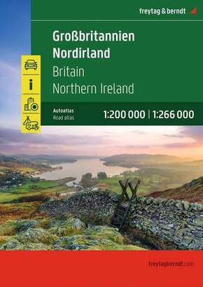
freytag & berndt Autoatlas Großbritannien - Nordirland 1:200.000 - Straßenatlas mit Spiralbindung, Camping- und Stellplätze, Freizeitinfos
Spiralbindung - zu den Produktdetails
Reduzierte Artikel in dieser Kategorie

Preisbindung aufgehoben3
3,99 €6,99 €3
3,99 €
Preisbindung aufgehoben3
5,99 €30,00 €3
5,99 €
Produktdetails
| Verlag | Freytag-Berndt u. Artaria |
| Auflage | 1. Auflage, 29.04.2026 |
| Seiten | 328 |
| Format | 22,5 x 29,7 x 2,5 cm |
| Gewicht | 1003 g |
| Reihe | freytag & berndt Autoatlas |
| ISBN-13 | 9783707924985 |
| Bestell-Nr | 70792498A |
Produktbeschreibung
Autoatlas Großbritannien - Nordirland 1:200.000 - 1:266.000
Informationen zum Straßenatlas Großbritannien - Nordirland
- Großbritannien - Nordirland 1:200.000 - 1:266.000
- Spiralbindung
- Camping- und Stellplätze
- Touristische Informationen
- Ortsregister
- 64 Innenstadtpläne
- 328 Seiten, Format 22,5 x 29,7 cm
Der ideale Autoatlas für Großbritannien und Nordirland
Spiralbindung
Innenstadtpläne
Mehr Angebote zum Thema
